Swiss Travel System AG
Interactive map for travelling with the Swiss Travel Pass
The Swiss Travel Pass is the key to Switzerland's public transport network for visitors from abroad. With a single ticket, travellers can explore the whole of Switzerland by train, bus and boat. Tourists with a Swiss Travel Pass can use the interactive map for seamless orientation, including the Grand Train Tour of Switzerland and convenient direct connections from Europe to Switzerland, and benefit from seamless mobility by train, bus, boat and mountain railways.
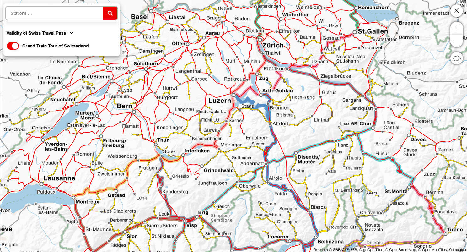
Map showing Grand Train Tour and direct connections from Europe
The Swiss Travel Pass map on swisstravelpass.com is based on the proven Trafimage system. It shows the Swiss rail, bus and boat network in a clear, cartographically consistent layout. Special attention is given to the well-known stages of the Grand Train Tour of Switzerland and direct rail connections from Europe to Switzerland. For each route, it is clear at a glance whether it is included in the Swiss Travel Pass or whether a supplement is required.
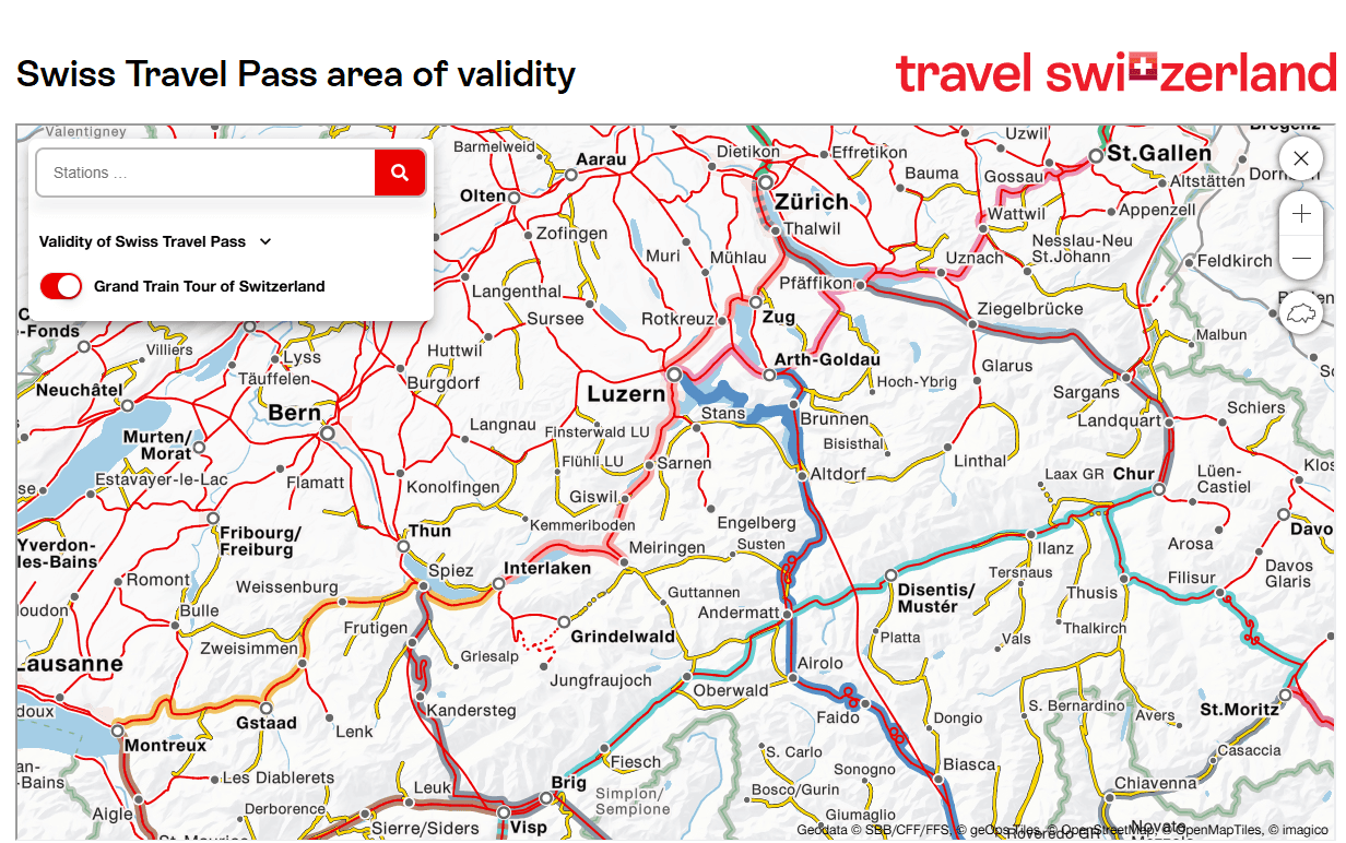
Orientation at a glance
The card is an indispensable tool for Swiss Travel Pass holders. It shows which connections and offers are included in the ticket at any time. Instead of relying on printed maps or scattered information, travellers have all the relevant data clearly and reliably available on their mobile devices.

Looking ahead: rethinking digital travel companionship
Attractive and clear map material is an important tool in tourism marketing. Our map bases meet this requirement perfectly. Combined with important information that can be accessed via the map, they are not only an information medium for travellers but also enhance the positive experience and memories of a trip. Our credo is therefore that interactive maps cannot be overrated in tourism.


«For our digital map solution, it was crucial to implement a technically sound, future-proof and low-maintenance solution. In geOps, we found the ideal partner for this. We were particularly impressed by the structured integration of the STS validity areas from the NOVA database. Thanks to the direct data transfer and the targeted adaptation of the data structure, we were able to significantly reduce our internal maintenance effort while ensuring sustainable data quality. We greatly appreciate the professional implementation, transparent project management and reliable, solution-oriented cooperation with geOps at all times.»
Gianluca Rossi, Project Manager Marketing Production, Swiss Travel System AG


